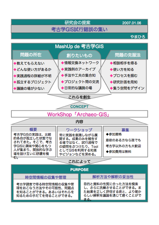
ワークショップの設立趣旨Archaeo-GIS Workshopは、考古学の研究にGIS(地理情報システム)を使ってみようかなと考えている研究者の、研究機関の垣根を越えたゆるやかなコミュニティです。研究成果を報告する場というよりはむしろ、そこに至るまでの失敗談や、GISを研究ツールとして利用する際の問題点・ノウハウなどを話しあい、学びあう場をめざしています。  |
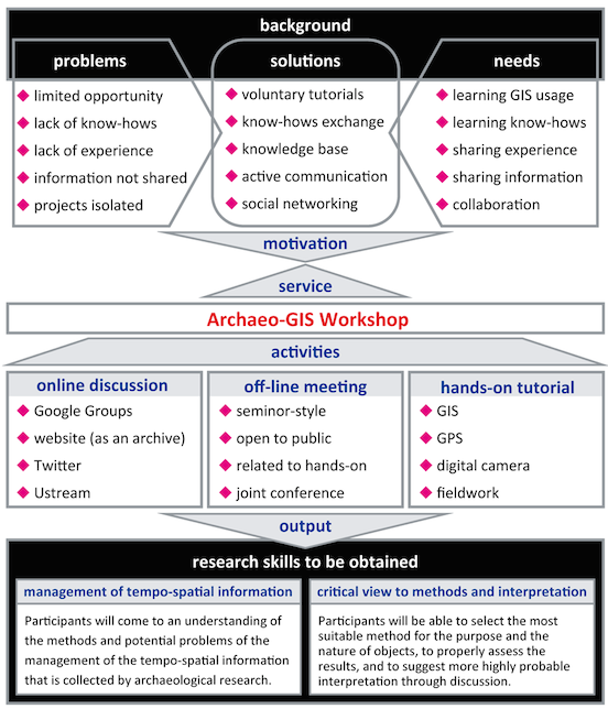
Concepts of the Archaeo-GIS WorkshopArchaeo-GIS Workshop (AGW) is a self-motivated study group of archaeolgy and GIS (Geographic Information Systems/Science) inaugurated by graduate students in 2007. It employs two complementary communication channels to create a scientific “agora”: active, informal online communication through social networking services (e.g., Google Group, Twitter, and weblog) on one hand and off-line workshop based on hands-on exercises on the other hand. The former facilitates exchange and discussion of new ideas, common problems, and practical tips through threads of discussions, while the latter encourages more in-depth discussions concerning particular topics such as (1) on-site collection of geospatial data using handy GPS receivers, (2) attachment of Exchangeable Image File Format (Exif) information to digital photos, and (3) georectification of hard-copy maps by means of open source GIS software.  |